 The barely known history of an Argentine Antarctic shelter, the Teniente Luis Oscar Ventimiglia Hut, installed by the Argentine Antarctic Institute on Peter I Øy (Peter I Island) in March 1971 has been reported on some dedicated articles from which, WAP has taken an abstract.
In examining the history of the only Argentine Antarctic facility outside of the Argentine Antarctic Sector, this article describes the reasons behind the establishment of the Hut and the scientific work that took place there as well as previous Argentine expeditions to Peter 1st.
On 3 March 1971 a group of scientists from the IAA inaugurated the Teniente (Lieutenant) Luis Oscar Ventimiglia Hut on Peter I Øy (Peter I Island). This became the most remote Argentine shelter in Antarctica. Peter I Øy is to the east of the Antarctic Peninsula, whereas the majority of Argentine stations are located on the western coast of the peninsula and islands located to its west: Carlini WAP ARG-2Ø (at the time known as Jubany), San Martín WAP ARG-Ø8, Melchior WAP ARG-13, Cámara WAP ARG-16, Brown WAP ARG-Ø2 and Decepción WAP ARG-12.
On 29 April 1964, the Antarctic Naval Group conducted a study to investigate the possibilities for establishing a Weather Sation on Peter I. In 1964 a complete survey of the island was undertaken and in early February 1965, the icebreaker ARA General San Martín headed towards Peter I Øy. Instructions were to conduct a general reconnaissance of the area and to determine the limits of the sea ice, anchoring areas, disembarkation points as well as potential helicopter and DHC-2 Beaver airplane landing sites.
By mid-February 1971 the icebreaker ARA General San Martín, left Ushuaia for the fourth stage of its annual voyages, with nine people on board specifically for the mission to Peter I Øy. On March 2nd at 16:00, a first flight was performer with a Navy Aviation Alouette III S-31 helicopter with the director on the IAA, Guillermo Mackinlay, and the Antarctic commander, Captain Roberto Ulloa, on board. During that dangerous flight, under whiteout conditions, landing at Evaodden (Eva Cape ) was made possible by the use of coloured smoke grenades to visualize the ground. Once on land, Mackinlay expressed his profound happiness, claiming to have been waiting 18 years for that moment since the first conceived plan onboard the ARA Bahía Buen Suceso in 1953.
The same day, three hours after of the first flight, an Argentine Air Force UH-1H Huey helicopter transported scientists and logistics personnel, camp equipment and the prefabricated shelter. The group undertook several scientific studies and established a camp (marked with a red spot in the map below), in the vicinity of Evaodden (Eva Camp WAP NOR-Ø8), some 500 m from the coast, south-east of Tvistein Pillars. The men began to assemble the shelter and, the following day, the seven members from the DNA-IAA and the two from the SMN were taken to the site, where they carried out a series of scientific measurements. Among the activities was the exact determination of the coordinates of the island, possibly motivated by a report by the IAA glaciologist César A. Lisignoli dated 31 August 1970, in which he stated that its geographical position was not well determined on account of different positions given by previous expeditions (Lisignoli 1970). A few metres from the camp that had been established, upon a visit from Mackinlay and  Ulloa, the shelter was inaugurated with the name Teniente Luis Oscar Ventimiglia at 68°42’South, 90° 36’East.
The Hut was a prefabricated model similar to others set up in the 1970s by Argentina in Antarctica. Its rectangular base was nearly square (2.36 × 2.46 m), with the front and back panels slightly longer than the sides. There was a door at the front, which faced east, and each of its shorter sides had a small window. Because of the difficulties encountered, including challenging weather and terrain conditions, the original idea of maintaining a regular summer crew at Ventimiglia Hut was discarded. Additionally, the particular meteorological conditions of the island proved that a Station established there would not improve weather forecasting for the Antarctic Peninsula area, so the main purpose for the establishment of the hut was considered no longer valid. For these reasons the final report of the Antarctic Naval Force recommended not returning to Peter I Øy and to abandon the Hut
Thanks and Cedit to: Pablo Gabriel Fontana and Instituto Antártico Argentino, Buenos Aires.
Read the full article at: View of A hut too far: history of the Argentine Ventimiglia shelter on Peter I Øy (polarresearch.net)
Later attempts to find the hut failed, but given the conditions at the site where it was established, it is assumed that the hut became buried in the snow, collapsed and was lost to the sea. (Report dated 2018).
As far as we know, no HF amateur radio activities have ever been carried out from Teniente Luis Ventimiglia Hut at that time and considering the fact that no more signs of the hut has remained on the site, WAP is still evaluating if adding it on the WAP-WADA Directory or not.
 Last season a number of construction milestones including making the new science and operations facility, the Discovery Building, weathertight and the runway replacement lighting becoming operational has been completed. The upgrades completed to the runway lighting and operational equipment ensure resilience and maintain safe flying operations at Rothera Station (
 The Antarctica shown at the Liguria DX meeting by one of the most experienced veterans of the Italian expeditions in the White Continent, has received appreciable approval from the participants at the Meeting organized by the ARI (Italian Radioamateurs Association) of Sanremo in the wonderful Riviera, not too far away the French border.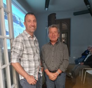
 TNX
TNX  Blaiklock Island Refuge located on the North side of Blaiklock Island at 67°32’South, 67°12’West, was established in 1957 and used intermittently from 1957 to 1958 as a refuge and satellite base for survey and geological parties from nearby bases.
 Find out more at:
  Next Saturday, October 5th, in the wonderful and famous setting of the city of Sanremo, Liguria Region on the Italian Riviera, the local Amateur Radio Club has organized a DX Meeting where, in addition to various technical topics relating to the world of radio, a special section is dedicated to Antarctica.
 This year, is quite possible that Danilo IAØ/IZ1KHY will work again in tandem with his friend David Brunet FT4YM who will be in Antarctica as well in the same period.
 The objective was to support the actions aimed at crossing the Antarctic below the Antarctic Circle, at the height of the Argentine Base San Martin, and also to annually install a scientific shelter so that it could be used by the members of that Polar exploration. A snowmobile provided by Tierra del Fuego (
 In the following years, the construction of new shelters in homage to other native peoples of Tierra del Fuego would continue. (
 This week, our friend and
  Why an International Polar Year in 2032–33?
 The
The  I
I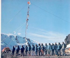 n late 1975, the Italian explorer Renato Cepparo and his 14 crew members were about to embark on a private expedition to Antarctica. The expedition had been given a clearance by the Antarctic Treaty System, and the crew members were prepared to establish Italy’s very first Base in Antarctica.
 After many vicissitudes, Cepparo’s expedition landed in Antarctica and the Base, was built, this is a fact. The Giacomo Bove Station, named after a 19th century Italian explorer, was inaugurated on January 20th, 1976.
 The evidence says that Argentina did destroy Giacomo Bove Station when in September of 1976, they sent an icebreaker to the South Shetland Islands to tear down the newly inaugurated Base. In the middle of the Antarctic winter, the Argentians did take the Base off in the same time it had taken to construct: three to four days. The materials, which had just arrived in Antarctica, were transported back to Buenos Aires. Prof. Fabbri strongly believe that, some if it, either hidden or forgotten, is still stored in a military facility in the Argentinian capital.
 As a day job, Julius Fabbri (IV3CCT-II3BOVE) teaches science at a high school in Trieste, a city in northeastern Italy, but since he was young his hobby has been to be a radio operator. And in the Italian hobbyist radio operator community the story of Renato Cepparo’s Antarctic mission, a story that is otherwise not well-known, has become legendary.
 Back in 2008, for instance, as a project in his science class, Prof. Fabbri and his students built a full-scale model of the ruins of Giacomo Bove Base, and a few years later, he helped design a virtual 3D model of it.
 The first days of spring in the Antarctic: for over a month, the island of Galindez has been almost completely packed with ice
 Sea ice plays an important role in the Antarctic ecosystem. It acts as a “blanket” that separates the ocean from the atmosphere. In addition to blocking sunlight from entering the water and reflecting it, the ice also traps the heat in the ocean, preventing it from heating the air.
 A mid-July, minor Sudden Stratospheric Warming event saw the vortex become elongated, weaker, wobbly. This stratospheric anomaly affected tropospheric weather patterns, but now appears to be easing. In late July and early August, a rapid stratosphere-troposphere coupling contributed to the development of a major high pressure cell and heatwave over Antarctica, while a very deep low formed over the Southern Ocean, and a heat dome affected Australia. It was associated with relatively cool conditons in Chile and Argentina.
 East Base,
  East Base was established in 1939 by the U.S. Antarctic Service Expedition, constructed in 1940 and occupied by them from 1940 to 1941. Later it was reoccupied in 1947-48 by the private Finn Ronne Antarctic Expedition. This marked a period of cooperation between the American and British stations, according to the history told by the British.
  The Antarctic Service Expedition was the first government-funded expedition of Admiral Richard E. Byrd (his first two expeditions in 1928–1930 and 1933–1935 were privately funded). East Base was built using Army knockdown buildings and a crew of 23 led by Richard Black, after Admiral Byrd had to return to Washington on the USS Bear.
 The war time pressures and pack-ice in the bay which prevented ship movement led to the evacuation of the base in 1941 by air. Admiral Richard Byrd’s USAS Expedition built America’s earliest remaining Antarctic camp in March 1940; 4 prefabricated structures were built on: Main Building, Science Building, Machine Shop, and Outpost Hut , from which they explored and mapped Alexander Island, George VI Sound, and hundreds of miles of coastline.

 Leidos is the prime contractor supporting the U.S. Antarctic Program (
 ASC is celebrating the many aircraft that it relies on to support the
  Brno University of Technology and Masaryk University present a proposal for a new research station module on Nelson Island in Antarctica. The station will be used by the Czech Antarctic Research Program based at the Faculty of Science of Masaryk University.
  which is supported by the faculties and institutes of the Technical University in Brno, a technological partner of the Czech Antarctic Research Program.
 This module is used for testing architectural and technical solutions proposed by the Faculty of Architecture of the Technical University and for the presentation of Czech Antarctic Research.
 WAP
WAP
 Maximilian Maria Kolbe, born Rajmund Kolbe (Zduńska Wola, January 8, 1894 – Auschwitz, August 14, 1941), was a Polish priest and Franciscan friar who offered to take the place of a father destined for the hunger bunker in the Auschwitz concentration camp.
 Aniversary of Saint Maximilian Kolbe, Saint Patron of Hamradio operators, Radioclub Islas Canarias has been awarded a special callsign
  Now in the Northern hemisphere it’s almost summertime, the ideal period to travel to the northern latitude while in about 6 months time, it will be better heading to the South Pole.
 The US Cape Crozier hut at 77° 27′ 41″ South, 169° 11′ 13″ East, is situated on the NW side of a low peak (675 m) NW of Post Office Hill. A message post from Scott’s National Antarctic Expedition (1901-04) is situated in West Colony (169° 14′ 37.5″ E, 77° 27′ 16.7″ S) and was designated as Historic Site and Monument (HSM) No.69 through Measure 4 (1995). The area is Antarctic Specially Protected Area (ASPA) No. 124.
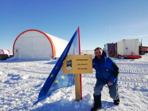
 An Automatic Weather Station (AWS) named Laurie II is istalled at Cape Crozier, situated on the Ross Ice Shelf 35 km east of Cape Crozier. Air temperatures recorded at Laurie II between 2009-13 showed December as the warmest month over this period, with a mean temperature of -5.8º C, and August as the coolest with a mean temperature of -33.1º C.
 The nearest protected areas to Cape Crozier are on Ross Island: Lewis Bay (ASPA No.156), the site of the 1979 DC-10 passenger aircraft crash is the closest and 45 km west; Tramway Ridge (ASPA No.130) near the summit of Mt. Erebus is 55 km west; Discovery Hut on the Hut Point Peninsula (ASPA No.158 and HSM No.18); Arrival Heights (ASPA No.122) is 70 km to the SW adjacent to McMurdo Station; Cape Royds (ASPA No.121), Backdoor Bay (ASPA No.157 and HSM No.15) and Cape Evans (ASPA No.155) are 75 km west; and New College Valley (ASPA No.116) are 75 km NW at Cape Bird.
 I was thrust into the hurly burly of Base routine prior to Christmas 1972 as a rush replacement for t w e appointed postmaster who was repatriated. A hurried week of medicals, x-rays, a dental check up, and a brush up on Post Office procedures, plus settling of my private affairs, was a prelude to the trip South.
 The measure is part of a newly published “Conservation Management Plan” (
 On 7 february 1959 while officially Australia took over operational command, the remaining US personnel at Wilkes did not take kindly to being under Australian control.
  he’s fighting to achieve a very specific goal: that of obtaining the recognition of Antarctic Specially Protected Area (
 In 2018 in Cervignano del Friuli (Italy), thank to the inexhaustible commitment of Prof. Julius Fabbri (
 In addition a 1:50 scale model of the “Giacomo Bove” Base (
 COMNAP
  The Council of Managers of National Antarctic Programs Annual General Meeting (
 The 46th Antarctic Treaty Consultative Meeting was held with an overarching theme of Tasudhaiva Kutumbakam a Sanskrit phrase which means one Earth, one Family, one Future. This resonates deeply with the Antarctic Treaty System, promoting peace, scientific cooperation. and preservation of Antarctica for mankind.
 45th Antarctic Treaty Consultative Meeting – Twenty-fifth Meeting of the Committee for Environmental Protection. Helsinki, Finland – 29 May 2023 – 8 Jun 2023
 Decisive has been the help of Scott WA4TTK who did provide his QSL of the contact with Jim Collinson W8IJK/KC4.
 Hello Gianni,
  Shackleton Field Camp (aka Shackleton Glacier Camp SHG) is located at 85°05’24” South, 175°19’48” West and lists on WAP-WADA Directory as

 On Tuesday 25th 2024, the New Zealand Hercules flew from Auckland to Christchurch, taking off at 02:00 local time and arriving at Phoenix Airfield (WAP USA-42) in Antarctica at 08:50.
 Concordia Station (
 43 years old, has been selected as station leader of the XX Winter Campaign of the
  Also from the Ukrainian Vernadsky Station (
 On the occasion of this year’s Midwinter Day,
  that have been made in polar science at this time. The
  shared with a new generation keen to learn about Antarctica. We also support other organisations to look after British Antarctic heritage sites in other parts of Antarctica. It is active in the promotion of Antarctic public engagement and supports institutions who have a connection to Antarctic heritage through their collections or education and outreach.
 with all the Antarctic chasers and followers. Thanks to eveyone sharing happyness with us on the Midwinter 2024 by sending us greetings and wishes.


 After suffering from a progressive illness that had recently kept him away from amateur radio, Cosme Alfonso “Pupi” Averna died last june 19 2024 in Ushuaia (
 He was born in Bahía Blanca on July 3, 1948 and at a very young age, he joined the Argentine Navy. In 1984 he was assigned to the Ushuaia Naval Base where he worked in the Weapons Workshop, specializing in ammunition and explosives, retiring after reaching the hierarchy. of Senior Warrant Officer.
 Once he retired from his work activity, he bought a motor home with which he traveled thousands of kilometers throughout Argentina for years, visiting colleagues with whom he had made friends through the radio.
 A good recall of “Pupi” was sent by Volker DL8JDX, a well known Antarctic veteran; Volker said: « I am very sorry about Pupi LU8XP sk. I had the luck to make acquaintance with him in Ushuaia Jan. 28, 2023 …»
 Plateau Station was the highest and most remote scientific station established by the United States. Construction of the site, started on December 13, 1965, and the first Traverse Team (named SPQML II) arrived in early 1966. The station was located at 79° 15’ South, 40° 30’ East in the far interior of the Antarctic ice cap, 11,890 feet above sea level.
 when it was closed but mothballed for future use. Plateau Station was also the coldest of any United States Stations on the Continent and the site for the world’s coldest measured average temperature for a month at that time, recorded in July 1968, at −99.8 °F (−73.2 °C).
 Actually Plateau Station is an inactive American research and support Base on the central Antarctic Plateau.
 In 2017, the CoFi-Expedition made a stop at Plateau Station. They entered the Station through a hatch at the top of highest building, the watch tower. The Bse is completely snowbound nowadays. The only visible building at the base is the meteorological tower. The expedition left the base with the same general impression as the expedition in 2007 did.
 Lion Island 66° 39′ 32″ South, 140° 00′ 53″ East is small rocky island 0.2 mi NNE of Petrel Island in the Geologie Archipelago. It was surveyed and named by the French Antarctic Expedition of 1949-51 under André Liotard. The name derives from the rock summit of the island which has the shape of a lion’s head.
 Pollux Islet a rocky islet in the Pointe-Géologie archipelago (Adelie Land) and Zeus were themselves two rocky islets in the same site; Zeus islet had the bad idea of being located in the axis of this track, between the Pollux islet, 100 mts to the Northwest, and the smallest of the Buffon islands, 100 mts to the southeast. Lamarck Island, a rocky island located 250 mts away to the southeast of Pétrels Island in the fateful NW-SE alignment of Cuvier, Lion and Buffon in the central part of the Pointe-Géologie archipelago, was spared by the construction of the Lion trail.
 On September 21, 1994, the Minister of the Environment Michel Barnier formalized in the Council of Ministers the abandonment of the Adélie land trail.
 HI Folks,
 Not too much to report from Antarctica at this time of the year The White Continent is actually in the deep winter, waiting the 2024-2025 Summer Antarctic Campaign.

 Here below the sites where David did operate from:
 Antarctic Campaign 2022-23
 George Island by air.
 coexist in this place where the development of science is the priority. Uruguay is present in the area and has been part of the Antarctic Treaty for 40 years. El País traveled to Antarctica in February 2024 to learn first-hand how the Artigas Antarctic Scientific Base works, who travels to that place, why Uruguay has a presence and how people live on this Continent.
 The “Capitán Estivariz Aeronaval Refuge”, is located on Watkins Island in the Mikkelsen islands group (
 Note:
Note: The author of this article tells one story from its rich history. Roald Amundsen is probably most famous for being the first to reach the South Pole in the ‘race’ against Robert Falcon Scott. Tragically, Scott and his companions died in their attempt. While they were still trudging through the snow, Amundsen had completed his mission and returned to his base camp, boarded his ship, Fram, and headed back to Hobart.
 The Base “Y” at Horseshoe Island (
 VP8DLM operated by Mehdi F5PFP was active from this rare site on March 2011, giving many of the Antarctic hunters a real
  Polish Demay Refuge provide limited accommodation capacity for 4 people with field medical kit available during summer for emergency use. The scientific use, is subject to the permission of the appropriate authority. The refuge (wood hut) is situated on a flat marine gravel terrace in Paradise Cove between Demay Point and Uchatka Point, ca 10 km from Arctowski Station (
 Lions Rump Refuge
  Probably, the old days, those in which CW and SSB were the best expression of the world of Amateur Radio will never come back, but fortunately, there are still young people that, to the most modern digital transmission/reception techniques (such as FT4/FT8, in which is the PC that makes QSOs), those youngs prefere the traditional ways, those that truly have the charm that takes you inside!
 website: “I relive good memories as I read her lines, emotions arise and fingers frozen too” was his comment!
 Petrel Base opened in 1967 but has been used as a temporary summer base since 1976, after a fire destroyed its main accommodation building. Petrel Base (
 The New Petrel structure took into account all the technological innovations of recent decades and all the scientific knowledge about the climatic and geographical conditions of Antarctica that was produced at this time. We also studied the projects of Countries that built Antarctic bases in recent years.
 One of the southernmost buildings in Antarctica is, curiously, a religious building. Let’s think about the St. Ivan Rilski Chapel, the first Eastern Orthodox edifice in Antarctica and the southernmost Eastern Orthodox building of worship in the world. Located at the Bulgarian Research Station, San Kliment Ohridski Base (
 It is not only its location, but also its peculiar shape that catches the eye: St. Ivan Rilski Chapel it’s a small trapezoidal building measuring 3.5 meters by 12 meters made of red metal that rests on small pillars.
 Touring the facilities of the huge Esperanza Base (
 The first church in Antarctica is the colorful Chapel of St. Francis of Assisi, which opened its doors on February 18, 1976. At that time, its priest was the Jesuit Buenaventura De Filippis, who was born in Italy and spent an important part of his life at the Esperanza base in Argentina. And, curiously, this chapel was also the place where, two years after its inauguration, the first religious wedding in Antarctica was organized.
 Ranui Station (aka North Hut-Ranui lookout hut) located at Port Ross on Auckland Island at 50°32’3Ø” South, 166°15’4Ø” East was maintained by a Team of 4-5 men from 1941 until 3 June, 1945. The first recruits came from the NZ Post & Telegraph Service, but from 1942 scientists were included. Various scientific work took place from wildlife research to detailed meteorological observations. During 1944-45, a survey party led by Flight Commander Allan Eden undertook the first full topographical survey of the Auckland Island group. The complex, included a base hut, ancillary huts, long drops, radio masts, landing areas, and tracks hidden in the rata forest, out of sight from the sea. The hut itself is located
  just below the ridge above the base and provides a clear view of all the entrances to Port Ross. At first, private messages were restricted to bereavement or other urgent matters, but later each man was allowed to send and receive two personal messages annually. The only news of the outside world was that heard over standard domestic radio, and other morse code transmissions picked up by the radio operators.
 ZL9/K8VIR & ZL9DX did operate from Ranui Cove (WAP NZL-Ø9) in the year 1997 …. Maybe it’s time for some others DX-peditionners to try again, isn’t it?
 Prefabricated 3m square huts of weatherboard construction with bitumen roofs were shipped to the Auckland Island in 1941. One was built at Port Ross in the North and the other at Carnley Harbour on the South end of the island.
 Radio amateur’s passion is often linked to “Philately”, especially that which recalls the Arctic and Antarctica but also, always in terms of radio contacts, also to the Space as in the case of the International Space Station
  A hobby or a passion?
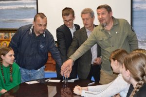 travel researcher, postal historian, winner of the “Geographical Oscar”, author of the term “philaturism” presented by “Bottle Mail”, “Traveller’s Mail” and “Polar Mail“, which include postcards, vignette stamps and a special postmark, Valery Ivanovich Sushkov RMØL and students at one of the secondary schools in Ryazan.
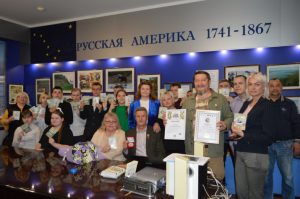 The purpose of the historical-geographical, scientific-educational, film-publishing, tourism-local history and memorial Project “Great Russian Travelers” is the revival of the traditions of Russian travelers in research and discovery, the popularization and promotion of tourism and postal business, highlighting their contribution to the economy of Russian society and the development of ties between the peoples of different countries.
 Thanks to the efforts of the staff actually on Petrel Base (
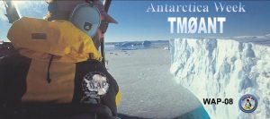 We must say that the 1st edition (2004) of the
 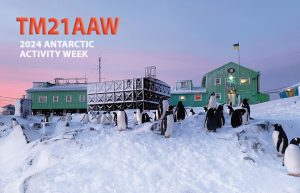 The picture on TM21AAW’s card, shows the Ukranian Antarctic Akademic Vernadsky Station (WAP UKR-Ø1) located at 65˚14′ South, 64˚15′ West, Marina Point on GalindezIsland in the Argentine islands Archipelago. The Faraday British Research base was established there in 1947 and transferred to Ukraine in 1996.
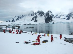
 beauty. On those occasions, a “Field Camp” is installed and who knows… maybe one day even an expedition of radio amateurs will give us the pleasure of this “
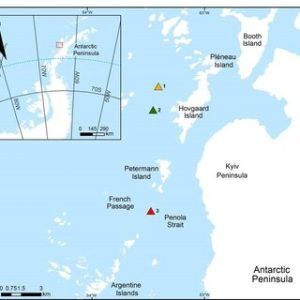
 has overtaken the original name in usage. The name Krogmann Point has been given to the western extremity of Hovgaard Island.
 gently sloping smooth rock and snow.
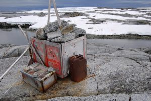
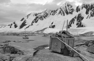 The cache is located up high on weathered stone where it is unlikely to be troubled by snow or ice during the winter. The cache contains emergency supplies for trapped ship-wrecked expedition; inside will be timed food, fire supplies and a tent.
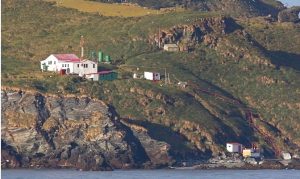 Gonzalo Island (56° 31’ 15” South, 68° 42’ 40” West), is a Sub-Antarctic island, uninhabited except for a Weather and Research Station (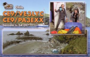
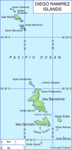 The important mission of the Diego Ramirez Island Lighthouse
 April 5th 2024, INDIA’s NCPOR 24th Foundation Day
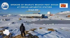 In this historic moment, as a part of the foundation day celebrations, the Indian Postal Services, in collaboration with NCPOR, inaugurated a new Branch Post Office at Bharati Station (
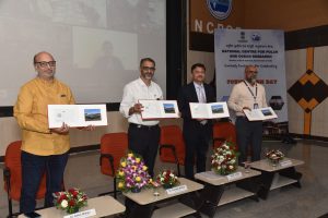 Chief Postmaster General Mumbai, Shri K.K. Sharma, officiated the opening, unveiling a special Picture Postcard of Bharati Station that was released on the occasion with the presence of Shri. R. P. Patil, Director Postal Services, Goa Region, Dr. Thamban Meloth, Director NCPOR, Dr. Rahul Mohan, Group Director and Scientist at NCPOR and the Team leaders of Maitri and Bharati Stations.
 India’s first post office in Antarctica was setup in 1984 at the Dakshin Gangotri Station, which was the country’s first scientific base there, according to a report by Indian Express. Around 10,000 letters and mails had been posted and cancelled at the icy continent’s post office. Significance of post office with Indian address in Antarctica The Antarctica has 2 research stations – Maitri and Bharati – both are a part of the Goa postal division.
 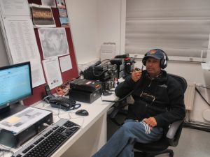 In the list taken from the dedicated Indian philately history of Abhai Mishra’s book (see
 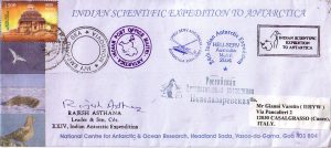 In 1988-89, the Dakshin Gangotri Station (
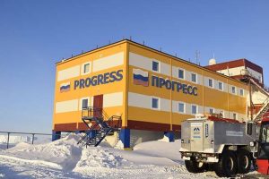 Igor is very active on all bands, Actually it’s easy to work him CW on 10 mts as conditions seems to be good on 28 MHz, but also 20 & 40 mts.
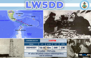 It was a chance with profound symbolic value; losing it would have been a real shame.