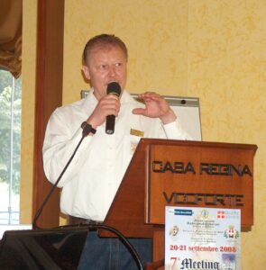
 Thanks to Dr. Volker Strecke DL8JDX (ex Y88POL) a well known German Antarctic veteran (pic aside), WAP is now able to retrace the history of two unknown Huts, later joined and became a Refuge.
These two forgotten Huts and a Refuge will be inserted into WAP-WADA Directory which, day by day becomes more and more accurate. Even if these Huts and Refuge have been dismantled and removed, it will be great to document their existence.
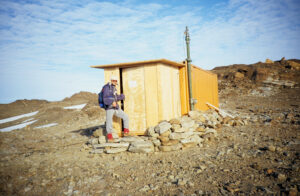 Lake Podprudnoye Hut, (WAP DDR-NEW) Built in 1987, this Hut shown on the right, was a living container which was placed at that site as, at that time it was considered to build a new Georg Forster Station nearby. Later this plan was cancelled.
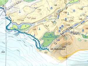
The Hut was located at 70°46′ South, 11°37′ East, close to Podprudnoye Lake.
(the two Pics to the Right, show the hut on its positions on Podprudnoye. The man near the hut is Volker. Pictures were taken from different angles) 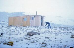
Lake Prilednikovoye Hut, (WAP DDR-NEW) located at 70°46′ South, 11°36′ East , (see picture below to the Left) was built in 1985 and remained in operation till 1988. It was located close to Prilednikovoye Lake.
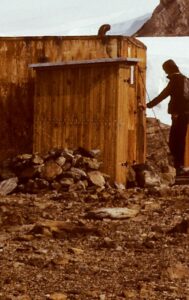 A decision decision to join Lake Podprudnoye Hut with the other hut moved from Lake Prilednikovoye was taken in the Antarctic summer season 1988-1989 .
Old hut from the Lake Prilednikovoye was relocated and combined with the hut existing at the northern coast of the Lake Podprudnoye. Both Huts together were called “Domik” (hut in Russian language) , they were set at 70°46′ South, 11°37′ East..
Both Lake Prilednikovoye Hut and Lake Podprudnoye Hut were about 9 km west from the site of Georg Forster Station (WAP DDR-Ø1)
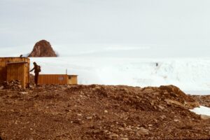 Picture aside shows both huts together.
Lake Podprudnoye Hut (at his second and last setup) was though formed by both the huts present in that area: the one moved from Lake Prilednikovoye and the Hut already in place at Lake Podprudnoye.
This Refuge did remain on place from 1988 through 1993 when it was dismantled
A detailed map below, show the locations of both Lake Podprudnoye and Lake Prilednikovoye
Volker DL8JDX wrote: «These huts were used as small support base for the scientific activities in the western part of the Schirmacher Oasis. Because this area of the Oasis could be explored only by foot, it was good to have a shelter to work and sleep apart of the main Station».
Volker said that there were no Hamradio activities from these two huts, just VHF and HF radio traffic to the Georg Forster main station and neighboured bases even if «I was myself working and sleeping in the “Domik” at lake Podprudnoye between 1988 and 1992 several times».
TNX Volker Strecke, DL8JDX (info@strecke.de)
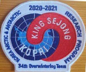 In a message just received, Lee Sang-hoon says that after 15 days of self-isolation, he will ride I/B Araon tomorrow.
 King Sejong Station,

 Beginners may have noticed, some cover with a handstamp of
  Korea’s Antarctic Scientific Base King Se-Jong (WAP KOR-Ø1). on King George Island, South Shetlands 62°13′ 26″ South, 58°47′ 27″ West
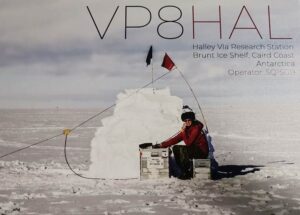 Seba SQ1SGB will sail to Halley VI(a) Base next December. He hopes to be active for 5 weeks, starting beginning of January 2021.
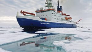 For a year the German icebreaker “Polarstern” was on a MOSAiC expedition in the Arctic to study the effects of climate change. In the early morning of October 12th, R/V Polarstern of the Alfred Wegener Institute for Polar and Marine Research is finally back in its home port of Bremerhaven.
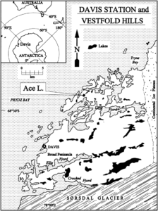 The Hut, 68°28’18”South, 78°11’16”East, is temporarily moved to the sea ice near the Plough Island skiway for up to 2 months in summer, then returned back to Ace lake.
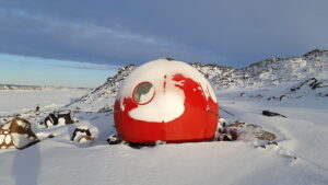
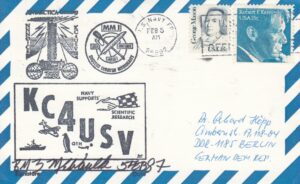
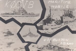 A rare old QSL of KØGVB/MM forced us to know a bit more about USS Burton Island (AGB-1), an icebreaker with a long and intense story. It could be that some Old Timers did work KØGVB/MM from 1967 and up, that was a great time to contact such a rare ones!
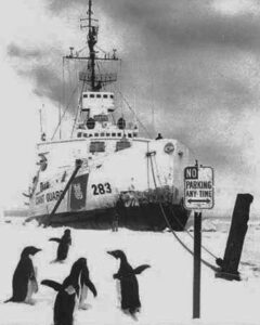 navigation, clearing channels through the ice for supply vessels, laying cables, delivering and dispatching the U.S. Mail at remote stations and vessels, search and rescue, fisheries patrol, law enforcement.
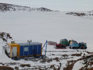 The Browning Peninsula Refuge (66°28’10” South, 110°33’00” East) is 21 km due south of Casey Station (WAP AUS-Ø2).
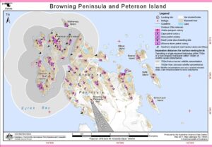 Browning is the furthest of the huts around Casey Station at about 60 km from station by GPS route. The area around Browning is spectacular with lots of hills, rocks and lakes. The Hut can sleep 6 people.
 Australia’s Aurora Australis is going to be gifted to Argentina to work on their Antarctic program, and will be sailed to South America by an Australian crew before the end of this year.
 A new earthquake of significant magnitude occurred on Monday afternoon (oct. 5, 2020) in Argentina’s Antarctica, reported the National Institute for Seismic Prevention (INPRES) based in San Juan.
 Radio Club Ushuaia is very grateful to the Hams that have operated from September 25 to 30 in a special radio event to celebrate 60 years anniversary of the creation of “Tierra del Fuego National Park” together with a tribute to the people who work every day to conserve and beautify this beloved national park Tierra del Fuego.